Hiking in Germany has never been so beautiful!

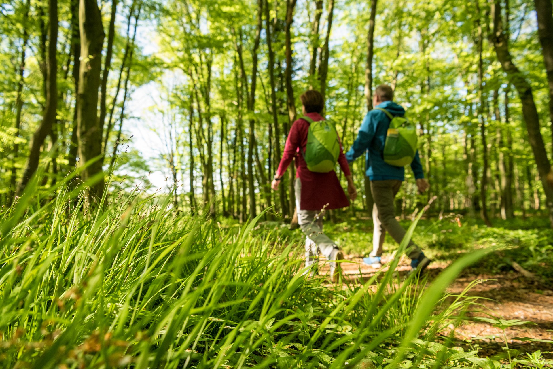
The Westerwald covers approximately 3,000 square kilometers, inviting hikers of all ages to use all their senses to soak in its beautiful surroundings, its attractive destinations and the atmosphere of its forests and valleys. The best way to do this is on foot. Why? Because the act of hiking gradually opens up the landscape to the viewer at the rhythm of their own steps. 

Digital hiking pass Westerwald

Explore the Westerwald in an interactive way and collect hiking pins on the WesterwaldSteig, the Wiedweg, the Wäller Touren and the Kleine Wäller.

More information about the digital hiking pass

Our hiking trails in the Westerwald

- km
- h

Westerwald-Steig Stage 1: Herborn - Breitscheid (East - West)
Moderate
4.8 h
16 km
506 hm
216 hm
The first stage of this trail starts in Herborn's market square and leads around the Dollenberg mountain into the Ambach Valley and on to Neuhaus. The trail continues through the Donsbach Valley, then follows the bird park to Uckersdorf, where it leaves the village in the direction of Gonkelrain. It climbs over the Kramberg and continues along the slopes of the Mühlberg mountain to Erdbach, with its 'Zeitsprünge' museum. Highlights of the tour are the Große and Kleine Steinkammer caves between Erdbach and Breitscheid, as well as the 'Herbstlabyrinth' limestone caves just before Breitscheid.

Westerwald-Steig Stage 16: Waldbreitbach - Bad Hönningen (East - West)
Difficult
3.8 h
12 km
256 hm
293 hm
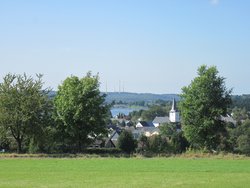
The Westerwald-Steig trail passes the St Joseph House in Hausen and heads over the Malberg mountain to the Rhine. The 373m high Malberg looks like a crater, but its lake is not volcanic – it was created by the former basalt mine here. You can ski here in the winter, but the ski hut is open all year round to cater for hikers. The Westerwald-Steig trail ends in Rheinbrohl with one more highlight – the RömerWelt living Roman history museum.

WesterwaldSteig adventure loop "Romantic Lake District"
Easy
3.8 h
15 km
101 hm
101 hm
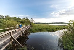
First we hike a bit along the Wiedweg in the direction of Dreifelden. Soon we meet the WesterwaldSteig and continue along the largest pond in the lake district, the Dreifelder Weiher. At leisure we watch the hustle and bustle of all kinds of waterfowl on the lake. As soon as we have left the Dreifelder Weiher behind us, we reach the Steinen-Dreifelden forest playground, which our little guests enjoy very much. After a short break, we continue on our way and soon arrive at the Postweiher, which attracts in summer with its varied activities such as swimming and pedal boating. We pass Freilingen and hike exhilarated through meadows and fields to the Wölferlinger Weiher nature reserve. Now it goes up to the 463 m high Schwengersberg, where we enjoy the magnificent view. From Rothenbach, the 7-pond hiking trail takes us back to Dreifelden through an impressive backdrop of indoor forests.

Wiedweg 01. Stage Linden - Höchstenbach

Moderate
3.9 h
16 km
40 hm
214 hm
The Wiedquelle rises under the roots of a centuries-old beech tree. From there we start and accompany the Wied in the direction of Dreifelden, where we can marvel at the oldest stone church in the Westerwald, the Trinity Church. On the banks of the Dreifelder Weiher, the largest body of water in the Westerwald lake district, we take a break on one of the benches, let our souls dangle and enjoy the breathtaking landscape. We follow the Wiedweg and leave the Dreifelder Weiher nature reserve in the direction of Oberes Wiedtal, where we come to the Steinebach sculpture park

Wäller Tour Brexbachschluchtweg (round tour - premium hiking trail)
Difficult
5.0 h
16 km
282 hm
282 hm
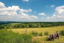
The Brexbach Gorge Trail leads us from wide heights with distant views to the Brexbach Valley. Idyllic forests, bubbling waters and a constant change of scenery provide excitement along the way. Again and again we cross the track of the Brexbach Valley Railway and admire the venerable viaducts. And the Grenzau ruins crown the tour with a touch of medieval flair...

Wäller Tour Elberthöhen

Moderate
5.0 h
16 km
315 hm
315 hm
The tour through the wooded and meadowy Stelzenbach valley near Montabaur offers pure nature. I start at the Hollerer Straße hikers' car park in Niederelbert. The next destination is the "Steinkaut" vantage point with its wide steps. In the forest, I learn a lot about the forest habitat on the bio-trail. Then I reach the Wolfskirchhof. The last wolf in the Westerwald was killed here in 1886. Mixed forest and wide fields follow. A trail takes me to Dielkopf. Behind Welschneudorf, I walk through a semi-open pasture landscape, later with fish ponds on the right. A small access path takes me to Oberelbert. I then walk past the Forellenhof and through the Stelzenbach valley into the forest. I walk uphill and stand below the "Rötchen" at the highest point of the path. Here is the wonderful wayside shrine "Maria Hilf" and in good weather I can see as far as the Taunus. The path leads me downhill from the "Hähnchen" hill to Niederelbert. The church is my last stop before I reach the hikers' car park.

Bad Marienberg - Kleiner Wäller "Wolfsteine" - walking trail
Moderate
2.0 h
7 km
129 hm
129 hm
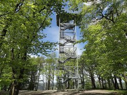
The Kleine Wäller Wolfsteine is a great circular hike for families and all hikers who love variety. The tour starts at the Bad Marienberg Wildlife Park, from where it follows forest paths to the Small and Large Wolfstones. Here you should take the time to read the legend of the Wolfsteine on the information board. The path leads over the Marienberger Höhe to the town centre. The spa park with its apothecary garden and barefoot path is definitely worth a stop. There are many places to stop for refreshments in the town centre, so you can start the last third of the hike well fortified. Continue towards the basalt park. Here you will find information boards about basalt mining in earlier times. The path leads past the basalt lake and the park's imposing basalt wall steeply uphill towards the wildlife park. Before you reach the game park, you pass the Hedwig Tower. Here you can enjoy the view over the Westerwald at the end of the hike.

Druidensteig - Stage 1 From Freusburg to Herdorf

Moderate
5.5 h
17 km
524 hm
542 hm
The 1 to 20 million year old namesake of this quality hiking trail, the legendary Druidenstein (National Geotope), welcomes us on this first stage in its extremely powerful form and, as a natural monument, is at the same time "the geological highlight" of our hike. From the Freusburg, which towers high above the Siegtal, the hiking tour runs in the Druiden.Hexen.SiegerLand of the Verbandsgemeinde Kirchen (Sieg) first to the Kahlberg with a unique view from the Ottoturm (GeoBlick) into the Siegtal and the Westerwald. In addition to the Freusburger Mühle, above Kirchen-Herkersdorf, we experience an even artistically designed historical Way of the Cross from the 1920s. In the stage destination Herdorf-Sassenroth, it is essential to plan a visit to the mining museum of the Altenkirchen district. This is a mining world for young and old. A complete mine was built in the basement of the museum based on the original locations in the region.

Quality hiking trails in the Westerwald

The WesterwaldSteig 235 km - 16 varied stages

The WesterwaldSteig, THE hiking trail in the Westerwald, guarantees variety, fun and enjoyment of nature on 235 km and 16 stages. The long-distance hiking trail is certified as a "Wanderbares Deutschland" quality trail by the German Hiking Association and is put through its paces every three years. Quality is the top priority in the Westerwald Hiking Trail!

The WesterwaldSteig is one of the Top Trails of Germany, the best hiking trails in Germany. For all those who want more. More joie de vivre, more adventure, more first-class hiking fun. 

View all
© (c) Stadtmarketing Herborn GmbH

Westerwald-Steig Stage 1: Herborn - Breitscheid (East - West)

Moderate
4.8 h
16 km
506 hm
216 hm

The first stage of this trail starts in Herborn's market square and leads around the Dollenberg mountain into the Ambach Valley and on to Neuhaus. The trail continues through the Donsbach Valley, then follows the bird park to Uckersdorf, where it leaves the village in the direction of Gonkelrain. It climbs over the Kramberg and continues along the slopes of the Mühlberg mountain to Erdbach, with its 'Zeitsprünge' museum. Highlights of the tour are the Große and Kleine Steinkammer caves between Erdbach and Breitscheid, as well as the 'Herbstlabyrinth' limestone caves just before Breitscheid.

Details
© https://creativecommons.org/licenses/by-sa/4.0/deed.en

Westerwald-Steig Stage 2: Breitscheid - Fuchskaute (East - West)

Moderate
4.3 h
17 km
274 hm
235 hm

The trail leaves Breitscheid in the direction of the airfield and crosses a wooded ridge, which eventually opens up on a view over the field to the village of Rabenscheid. The trail disappears into the forest again and leads down to the Heisterberger Weiher lake. It follows along the banks of the lake as far as the road to Heisterberg, through a landscape of hedge-lined meadows. You'll hardly notice the gentle ascent up to the highest peak (657m) in the Westerwald.

Details
© (c) Dominik Ketz / Westerwald - Ganz nach deiner Natur!

Westerwald-Steig Stage 3: Fuchskaute - Rennerod (East - West)

Moderate
2.3 h
9 km
55 hm
91 hm

Passing the Fuchskauten-Scheune restaurant and guesthouse, the trail leads downhill along the slopes at the edge of the forest until it reaches Rehe and the recreation area at the Krombach dam. It then follows a disused railway line as far as the Alsberg military barracks, passing the Hexenbaum, the Botterweck basalt boulder and the three emperor oak trees, before reaching Rennerod.

Details

WesterwaldSteig experience loops - hikable all around

Discover the WesterwaldSteig adventure loops.

The scenic and adventurous hiking tours in the Westerwald run along existing hiking trails, but do not have any independent markings on site. 

To help you find your way around at all times, you can find detailed tour descriptions and the corresponding maps for free download in our hiking tour planner. Here you can also conveniently download your route as a GPS track.

View all
© (c) Michael Sterr / Westerwald - Ganz nach deiner Natur!

WesterwaldSteig adventure loop "Romantic Lake District"

Easy
3.8 h
15 km
101 hm
101 hm

First we hike a bit along the Wiedweg in the direction of Dreifelden. Soon we meet the WesterwaldSteig and continue along the largest pond in the lake district, the Dreifelder Weiher. At leisure we watch the hustle and bustle of all kinds of waterfowl on the lake. As soon as we have left the Dreifelder Weiher behind us, we reach the Steinen-Dreifelden forest playground, which our little guests enjoy very much. After a short break, we continue on our way and soon arrive at the Postweiher, which attracts in summer with its varied activities such as swimming and pedal boating. We pass Freilingen and hike exhilarated through meadows and fields to the Wölferlinger Weiher nature reserve. Now it goes up to the 463 m high Schwengersberg, where we enjoy the magnificent view. From Rothenbach, the 7-pond hiking trail takes us back to Dreifelden through an impressive backdrop of indoor forests.

Details
© https://creativecommons.org/licenses/by-sa/4.0/deed.en

WesterwaldSteig adventure loop "Fuchsbau, Arnika and Bergeshöhe" (Foxhole, Arnica and Mountain Heights)

Difficult
4.8 h
18 km
270 hm
270 hm

-ATTENTION: The starting point at the Fuchskaute can no longer be approached since 2021. Alternatively, the following starting points are available: Breitscheid airfield Heisterberger Weiher campsite Our adventure loop starts at the Fuchskaute. At 657 metres, the Fuchskaute is the highest elevation in the Westerwald. Only a few metres from the former inn, the two top trails WesterwaldSteig and Rothaarsteig meet, where our official starting point for this circular tour is also located. But now it's time to hike along the Rothaarsteig in the direction of Rabenscheid. The horizontal R on a white background shows us the way through the peaceful Fuchskaute nature reserve. We see a meadow landscape with scattered trees, which is otherwise more typical of the Alpine foothills or Allgäu. Especially in autumn, when the early morning mist slowly rises and the dew still hangs in the grasses, we experience a unique natural experience. The constant change between forest and meadow landscapes provides the hiker with calming views over the rolling hills of the High Westerwald again and again. Shortly after Rabenscheid, the Rothaarsteig turns left towards Langenaubach. Now we have to be on our guard, because shortly afterwards we also leave the Rothaarsteig and hike along the Rothaarsteig access path (lying R on a yellow background) in the direction of Breitscheid. Before Breitscheid and at the same time at the height of the Breitscheid landing site, we meet the WesterwaldSteig at signpost BRE.002, which will now be our companion for the entire length to the starting point with its green W on a white background. However, we first walk along the WesterwaldSteig past the Breitscheid airfield, which is used for civilian purposes. Here you also have the opportunity to take to the air for a short while and view the landscape from above. Today it is difficult for hikers to imagine that during the Second World War Luftwaffe fighters took off from here and that history was made in this respect. Only a few contemporary witnesses remind us of this. After leaving the airfield, we walk again and further through the typical cultural landscape of the High Westerwald, with gently undulating basalt plateaus, the open landscapes and associated windbreak hedges. These spruce strips were planted between 1835 and 1838 as protection against the much-sung about Westerwald wind. They were intended to protect the farmland from erosion and the harvest from storm damage. The route continues along the protective hedges over the volcanic rock Bartenstein to the Heisterberg pond, through the Bermershube nature reserve with wetland biotopes and flower meadows. Willowherb, common ragwort and deer elder blossom here. The large proportion of open landscape on this section of the trail also provides the hiker with constant great views all the way to our starting point, the Fuchskaute.

Details
© (c) Michael Sterr / Westerwald - Ganz nach deiner Natur!

WesterwaldSteig adventure loop "Marienthal Monastery and the End of the World

Difficult
3.5 h
12 km
352 hm
352 hm

The circular tour starts at the hikers' car park in Marienthal. It goes up to the Sonnenberg with a resting place with a beautiful view. Immediately below, you can see the village of Ahlhausen, whose hilltop was once inhabited by Celts. Excavations here have proven the former existence of a refuge. One of the highlights of this adventure loop is the charming and alpine nature trail Weltende, which crosses one of the most beautiful sections of Kroppach Switzerland through untouched coppice woodland along the Nisterbogen in romantic silence. The Weltende trail is a path carved into the rock, where children used to have to walk to school in Stein-Wingert. In the vernacular, it is also referred to as the "end of the world". At Nassen, there is another magnificent view over hilly Kroppach Switzerland. In Marienthal, the pilgrimage church and the historically famous Franciscan monastery of Marienthal await. Legend has it that a shepherd often prayed in silent devotion before an image of Mary he had carved himself, and a first chapel was built for it around 1460. Several miraculous healings and resurrections from death were described, which led to a great pilgrimage and a church was built in 1494. A Franciscan monastery was founded in 1666. Retreats and educational events are still held here today. In addition, numerous pilgrims and processions also visit the place of grace. In Marienthal there are several places to stop for a leisurely end to the hike.

Details

On the way on a quality trail: from the source to the estuary

The Wiedweg

On the way on a quality trail: from the source to the estuary 

Just in time for the 2022 hiking season, the Wiedweg has now been certified as another Wanderbares Deutschland quality trail in the Westerwald. 

View all
© (c) Dominik Ketz

Wiedweg 01. Stage Linden - Höchstenbach

Moderate
3.9 h
16 km
40 hm
214 hm

The Wiedquelle rises under the roots of a centuries-old beech tree. From there we start and accompany the Wied in the direction of Dreifelden, where we can marvel at the oldest stone church in the Westerwald, the Trinity Church. On the banks of the Dreifelder Weiher, the largest body of water in the Westerwald lake district, we take a break on one of the benches, let our souls dangle and enjoy the breathtaking landscape. We follow the Wiedweg and leave the Dreifelder Weiher nature reserve in the direction of Oberes Wiedtal, where we come to the Steinebach sculpture park

Details
© (c) Andreas Pacek

Wiedweg Stage 2 Höchstenbach - Altenkirchen

Moderate
5.0 h
16 km
199 hm
264 hm

I'm looking forward to the second stage of the Wiedweg because it promises to be very varied. At the beginning of the hike, the late Romanesque, Protestant parish church of St. George in Höchstenbach fascinates me with its wall paintings from the 13th century. For about five hours I mostly follow the course of the Wied, also through the landscape protection area "Im Dorn" on the southern edge of Altenkirchen with its species and varied flora and fauna. In Michelbach, I marvel at the Michelbach mill, which still today, powered by the water power of the Wied, grinds up to 110 tons of wheat a day. With its six grinders, it is one of the largest mills in the region. The Mühlengraben is also still used (today for power generation). My highlight is the Bismarck Tower, which was restored in 2010. It is a monument and landmark of Altenkirchen at the same time and, at a height of 14 metres, offers a great view of the landscape in the northern Westerwald. (Information and opening hours: www.bismarckturm-ak.de) My hiking stage ends again at a Romanesque basilica worth seeing, this time in Almersbach. From here, only 1.5 km separate me from Altenkirchen train station.

Details
© (c) Andreas Pacek / Westerwald - Ganz nach deiner Natur!

Wiedweg 03. Etappe Altenkirchen - Oberlahr

Moderate
5.0 h
16 km
163 hm
208 hm

I enjoy the varied hike through the Rhine-Westerwald Nature Park and the alternation between lush meadows directly on the river and cooling forests on the ridges. On the way, I pass the Obernauer Kopf (265 m) into Raiffeisenland, named after the famous social reformer Friedrich Wilhelm Raiffeisen, who founded the cooperative idea here during his lifetime. Passing Seelbach and Seifen, the route continues to Döttesfeld, where the Holzbach, the largest tributary, flows into the Wied. At the rushing Holzbach, a Kneipp water treading facility has been set up directly in the stream - a refreshment that tired hikers' feet will enjoy. The neighboring barefoot path also promises a welcome change. An interesting extra of this tour is the 12th century basilica in Almersbach at the beginning. It welcomes me with a great location on a protruding ridge above the Wiedtal in the center of old trees and with amazing, well-preserved fresco paintings. At the stage destination Oberlahr I find not only beautiful half-timbered houses, but also the imposing parish church of St. Antonius on the village square.

Details

The Druidensteig - the longest certified geo-route in Germany

The Druidensteig

Hike the longest certified geo-route in Germany from Siegtal to the Westerwald and experience six river valleys, an abundance of geological points, charming views and beautiful places of interest on 83 kilometres and six daily stages.

The certified long-distance hiking trail is named after the Druidenstein, a unique basalt formation that has been declared a national geotope.

View all
© https://creativecommons.org/licenses/by-sa/4.0/deed.en

Druidensteig - Stage 1 From Freusburg to Herdorf

Moderate
5.5 h
17 km
524 hm
542 hm

The 1 to 20 million year old namesake of this quality hiking trail, the legendary Druidenstein (National Geotope), welcomes us on this first stage in its extremely powerful form and, as a natural monument, is at the same time "the geological highlight" of our hike. From the Freusburg, which towers high above the Siegtal, the hiking tour runs in the Druiden.Hexen.SiegerLand of the Verbandsgemeinde Kirchen (Sieg) first to the Kahlberg with a unique view from the Ottoturm (GeoBlick) into the Siegtal and the Westerwald. In addition to the Freusburger Mühle, above Kirchen-Herkersdorf, we experience an even artistically designed historical Way of the Cross from the 1920s. In the stage destination Herdorf-Sassenroth, it is essential to plan a visit to the mining museum of the Altenkirchen district. This is a mining world for young and old. A complete mine was built in the basement of the museum based on the original locations in the region.

Details
© (c) Christoph Eul, Mantomedia GbR / Westerwald - Ganz nach deiner Natur!

Druidensteig - Stage 2 From Herdorf to Daaden

Moderate
3.8 h
13 km
372 hm
316 hm

On the second stage of the Druidensteig we discover the natural beauties and geologically relevant points between the mining towns of Herdorf and Daaden. The so-called Silbersee on the Mahlscheid, where basalt was mined until the 1970s, is unique in terms of landscape. Other natural attractions are the beech in the Hüllwald near Daaden, which is one of the oldest trees in the region, and the basalt columns on the Hohenseelbachskopf. If you have not yet got to know the mining museum of the Altenkirchen district at the beginning of the hike, a visit to Herdorf-Sassenroth is definitely recommended. Narrow forest paths lead us up on this hiking tour and we enjoy the view of the entire city of Herdorf. We reach today's stage destination when we arrive in the city of Daaden, where there are numerous refreshment stops. The center impresses with the baroque church, some pretty half-timbered houses and the local museum.

Details
© (c) Christoph Eul, Mantomedia GbR / Westerwald - Ganz nach deiner Natur!

Druidensteig - Stage 3 From Daaden to Elkenrother Weiher

Moderate
4.0 h
14 km
271 hm
104 hm

Several nature and bird sanctuaries underline the natural landscape of the Westerwald during the third stage of the Druidensteig. Before we start our hike, it is advisable to get to know the mining town of Daaden with its baroque church, the local museum and the town center with its ornate half-timbered houses. On the approximately 14 km long hiking route, the information point on the Schimmerich tells about the former basalt mining. In Friedewald, the castle there stands out with its distinctive onion dome and massive wooden gate. Furthermore, today we reach the highest point of the entire Druidensteig with a height of 508 meters above sea level near Langenbach near Kirburg. The meadow paths over the plateau of the Neunkhausen-Weitefeld plateau are simply wonderful. Not far away is the Elkenrother Weiher, which is also the destination of this stage. We learn more about the occurrences on brown coal seams and the sticky sand pits.

Details

Wäller Touren - day and circular hiking trails in the Westerwald.

Immerse yourself in the regional diversity of the Westerwald hiking region! Here, varied routes and numerous highlights shake hands.

Hike the Westerwald on certified day tours between 9 and 22 kilometres in length, mostly in the form of circular trails.

View all
© (c) Dominik Ketz / Westerwald - Ganz nach deiner Natur!

Wäller Tour Eisenbachtal (round tour - premium hiking trail)

Easy
3.5 h
9 km
157 hm
157 hm

A wonderful trail with undeniable recreational qualities is located northwest of Nomborn in the Eisenbach Valley. Forest and water provide a pleasant microclimate here, especially on hot days. After starting at the hiking parking lot of the Studentenmühle, the trail leads along the Eisenbach through shady woods to the "Bildches Eich". Here, a small forest chapel from 1963 and a hollowed oak tree with a statue of the Virgin Mary from 1830 await the hiker. Back along the Holbach, where two mills invite you to rest at the end of the circular path.

Details

Wäller Tour Raiffeisens Sonntagsspaziergang - Hamm (Sieg)

Easy
1.8 h
7 km
80 hm
80 hm

Details

Wäller Tour Augst

Moderate
5.0 h
14 km
381 hm
382 hm

14 kilometres through the historiccultural landscape of the Augst bringme wonderful views and interesting sights. I startat the Neuhäusel-Ost hikers' car parkand reach the excellently marked premium trail. I head south alongmeadow paths in a southerly direction andenjoy the landscape. Natural paths lead through the floodplains of theof the Binnbach. There is a smallclimb before the forest. Then I hike up the Schlossberg to the accessibleSporkenburg ruins from the 11thfrom the 11th century. Thenthen descend along the Theilenbach stream to the L 329.I come across a farm track,I follow it in the direction of Arzbach across meadows and pastures. I satisfy my hunger in the old brewery. NowI climb up the Mühlberg, which I caneasier with the help of my trekkingeasier with my trekking poles. Wide views,including the watchtowers of theof the Limes, reward the effort. AtKadenbach there is a rest areawith a barbecue hut. The trail continues uphillto the "Maria in der Augst" chapel, which was only built in 1999/2000. Alast look at the surroundings andI walk back through the forestto the starting point.

Details

Kleine Wäller - walking (hiking) trails

For strollers who like to stroll and manage less long tours, the Westerwald also has low-barrier walking paths and strolling trails. The "Kleine Wäller" are suitable for those for whom the focus is on relaxing walking without special preparation and equipment, but also for occasional hikers who fancy short tours.

View all
© (c) Dominik Ketz / Westerwald - Ganz nach deiner Natur!

Small Wäller "Lion track 3 blue" - Hachenburg - walking trail

Moderate
2.2 h
8 km
136 hm
143 hm

The oldest water tank in Hachenburg is located along the trail and the Rothbach Grotto invites you to pause and take a deep breath. In the course of the route, there is a wonderful view of Hachenburg with its baroque castle at the so-called "summit cross". Through the district of the old town with the Hachenburg brewery, hop garden and historic ice cellar, you return to the traditional town center with its old market and golden lion on the fountain. Here you can let your soul dangle, before it goes through the castle garden to the finish point.

Details
© (c) Gemeinde Greifenstein

Kleiner Wäller "Basalt + Water" - walking trail

Easy
2.0 h
8 km
101 hm
101 hm

My way starts at the parking lot of the Ulmbachtalsperre. Over the dam I walk along the lake into the forest. Soon I discover a geological peculiarity: A comb quartzite cliff - originated from the formerly pure sandy beaches of the Lower Carboniferous period. I follow the Ulmbach over meadow paths and reach the village center of Beilstein with the beautiful basalt castle church from the 17th century. On the left side you will see Beilstein Castle. Once a count's residence, the restored basalt building is now privately owned. My way leads me over the splashing Ulmbach to the BASALT-PARKours, which shows me the many ways of using the stone. On the route of the former Ulmtalbahn railroad, which has been converted into the Ulmtal cycle path, I hike back to the Ulmbach dam, where I can enjoy the idyllic resting places and viewpoints.

Details
© (c) Yvonne Höller / Westerwald - Ganz nach deiner Natur!

Bad Marienberg - Small Wäller "Schwarze Nister" - walking trail

Easy
1.2 h
4 km
80 hm
80 hm

The Kleine Wäller Schwarze Nister is the second walking trail in Bad Marienberg. Here you can stroll leisurely and enjoy nature. And although the tour is only just under 4.5 km long, there is plenty to see, even in autumn and winter. In summer, a Kneipp treading pool or the little river itself offers cooling for feet and legs, and in the Bacher Lay it is always cool anyway. The basalt wall is worth seeing and you can also discover remnants of former basalt mining, always accompanied by the Black Nister. Sometimes it is closer, sometimes a little further away from the path. Back in the city, the Barefoot Trail and Apothecary Garden in the Park of the Senses await your visit.

Details

Good to know

Where is the best place to hike?

The best hiking routes are the WesterwaldSteig (a certified long-distance hiking trail with 235 km and 16 stages), the Wäller tours (a certified circular or day hike in the Westerwald) and the Kleine Wäller hiking route. You can find more information about the destinations on your hiking routes in the Westerwald.

To the destinations

How many kilometers can one hike in a day?

The distance one can hike in one day depends on one's fitness level, but also on the hiking route and its elevation profile. For inexperienced hikers, we recommend starting with half-day tours.

Tips for your perfect hiking equipment!

When hiking in the Westerwald, it is important that you have the right equipment on board so that your tours are a pleasure.

We show you what should be on your packing list. 

The right footwear as the basis for your hiking holiday     

If you're going hiking, you need the right footwear, of course. If you're planning longer tours, you shouldn't set out in conventional trainers, because you need the right grip on hiking tours. Therefore, opt for robust and, above all, comfortable hiking shoes.    

Tip: Never take new hiking boots with you on holiday, but break them in beforehand. Otherwise, the tour can quickly become an ordeal if you have bad blisters. Good hiking shoes should fit the shape of your foot, meet the requirements of the terrain and be as water-repellent as possible.  

Suitable hiking clothing for any weather. If you are planning extended hiking tours, you should also take the appropriate clothing with you.   

First and foremost these are:  

  • Hiking trousers (short and long)  
  • Hiking jacket  
  • Functional underwear  
  • Hiking socks    

Hiking clothing has special functional properties that are of particular benefit to you on strenuous tours. If you exert yourself, you will logically also sweat and therefore need clothing that absorbs sweat well and also transports it away again. Breathable functional clothing is therefore recommended. Once you are soaked in sweat and have not dried off again, it can quickly become cold, because wet clothing draws extreme heat away from the body.  

It's also important that you don't only plan for good weather. Everyone hopes for the best for their hiking holiday, but you should always expect the occasional rain shower. Rainwear is therefore a must in your rucksack on every tour, as it allows you to react quickly. Most rain gear also packs up so well that it hardly takes up any space in your backpack. 

Sun protection on hiking tours  

It is not only in summer that suitable sun protection is indispensable on your hiking tours. If you are always alternating between the forest and the meadows and there is a slight breeze, you will not notice how quickly you burn. Sunscreen with SPF30 should therefore be obligatory for your hiking tours, and sunglasses and light headgear are also part of the package. Even if the sun may not shine so strongly, you should protect yourself sufficiently, because especially in summer the sun can be very intense even through an overcast sky. And nothing would be worse than getting sunburnt, because then carrying your backpack on the tour the next day can be very uncomfortable. 

What else should I bring on hiking tours? 

Provisions & water 

Provisions and sufficient liquid are a matter of course on your tours, because if you are exerting yourself, you will also want to fortify yourself in between and will need more water than on less active days. 

Binoculars 

There is a lot to discover in the Westerwald. That's why you should take binoculars with you on your tours. For example, you might see some local animals that you would like to take a closer look at. It would be annoying if your binoculars were not at home or in your accommodation.    

Hiking map 

Although the hiking trails are usually well signposted, it never hurts to have a hiking map with you if you are hiking in the Westerwald for the first time or if you don't know your way around yet. This way you can always find your way around and even spontaneously extend or shorten the tour along the way.    

Important documents 

Nobody hopes it, but if you get injured on a hiking tour, you should be able to identify yourself and have your health insurance card with you. It's best to pack important documents like these in a plastic bag in your backpack. That way they are protected from the rain at all times and you won't have a rude awakening after a thunderstorm because everything is soaked.  

Off to the Westerwald! 

If you've packed everything, nothing can go wrong, because then you're well equipped for an eventful hiking holiday in the Westerwald recreation area (whether it's a hike on the WesterwaldSteig, circular and day hikes or walking trails).   

We wish you lots of fun and the best of relaxation!  

This article was produced in cooperation with Sportscheck. 

Digital hiking pass Westerwald

With the free Summit Lynx app, hikers can easily collect hiking pins in the Westerwald. When hiking on the “WesterwaldSteig”, “Wiedweg”, “Wäller Touren” and “Kleinen Wällern”, certain waypoints are passed. These can then be registered via the app. If all the points on a tour have been registered, you will be credited with a certain number of points. Once you have reached a certain number of points, you will receive the Wäller Bronze, Wäller Silber and Wäller Gold medals.

You will receive the corresponding badge digitally on your smartphone and a certificate by e-mail.

In addition, you can contact us by e-mail (mail@westerwald.info) stating your address and you will receive a surprise. P.S.: For each hiking medal, a different gift awaits you.     

And this is how it works:    

1. Install and start the app Summit Lynx in the "App Store" or on "Google Play"

2. Log in with your own Facebook account or create your own SummitLynx account.  

3. Select a tour in the Westerwald and start hiking.  

4. When you reach a waypoint on site, start the app and create an entry in the tour book by clicking on the suggested destination at the bottom.  

5. The waypoint/destination is now automatically credited towards the points collection.  

We wish you lots of fun! 

How long does it take to hike 10 kilometers?

On average, you hike 4 km/h, whereby the altitude profile of the hiking route should always be taken into account. For 10 km you need about 2.5 hours pure walking time.

Enjoy your time in the Westerwald

Hiking
Cycling
Camping
Bookable experiences
Destinations
Vantage points
Activities
Sightseeing features