Hiking Trail
Route profile
Notice
In the tour planner we inform you under the tab "Current info" about temporary route changes, closures and detours.
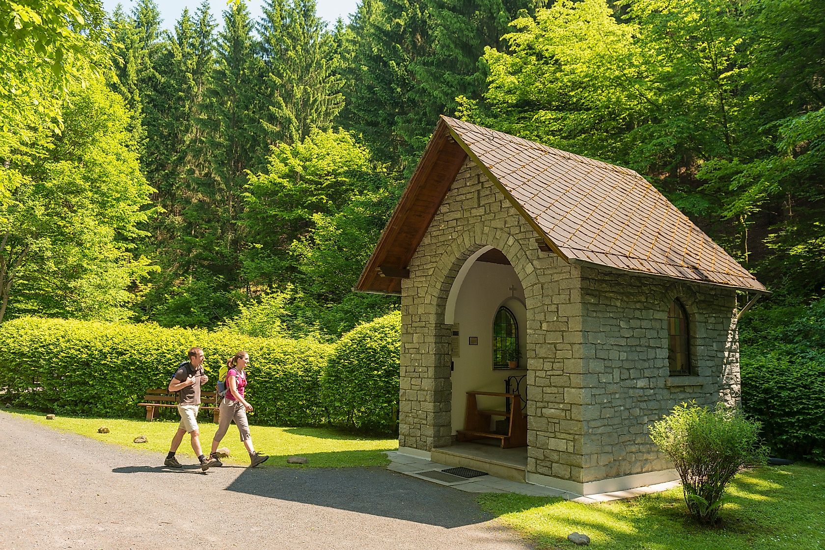
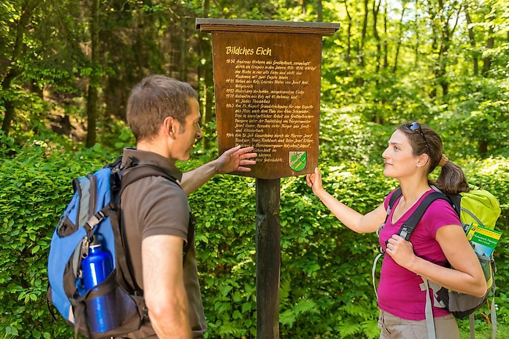
To the Tour PlanerA wonderful trail with undeniable recreational qualities is located northwest of Nomborn in the Eisenbach Valley. Forest and water provide a pleasant microclimate here, especially on hot days. After starting at the hiking parking lot of the Studentenmühle, the trail leads along the Eisenbach through shady woods to the "Bildches Eich". Here, a small forest chapel from 1963 and a hollowed oak tree with a statue of the Virgin Mary from 1830 await the hiker. Back along the Holbach, where two mills invite you to rest at the end of the circular path.
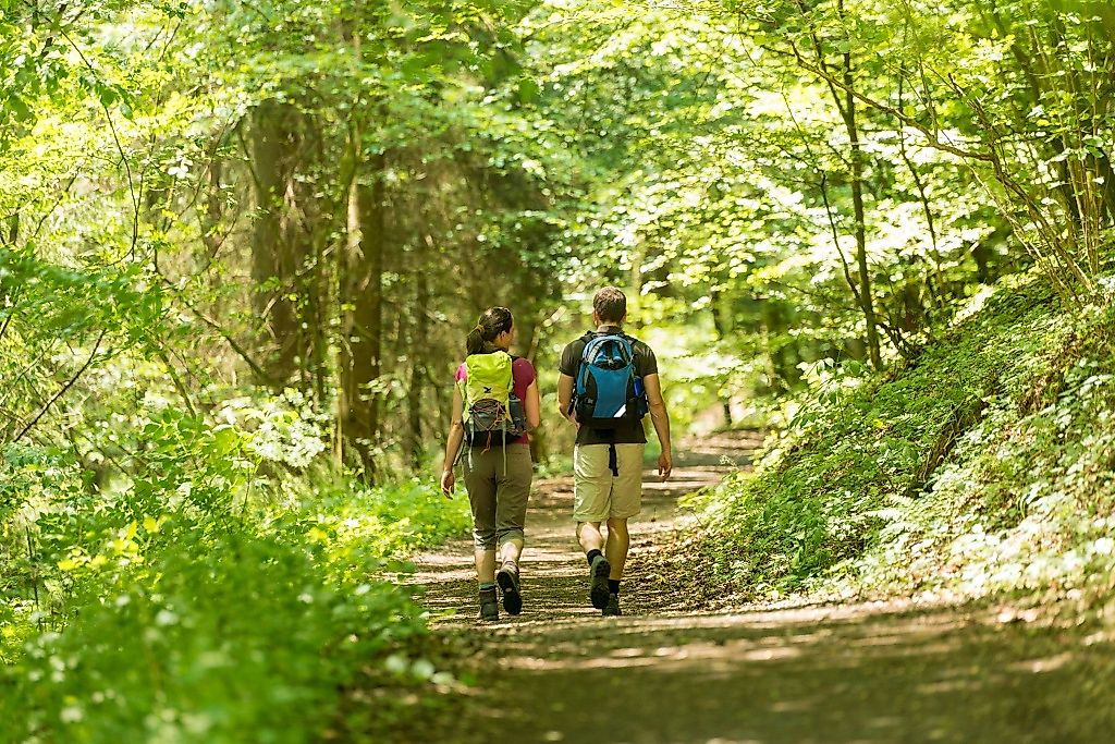
A refreshing walk always along the water! This 9 km long circular path is especially suitable for families with children and is ideal for a hike in summer.
From Montabaur or Limburg via the L318. The exit "Eisenbachtal" with the sign for the campsite and the two mills is signposted. Follow the path along the "Freimühle" and the camping site to the hiking parking lot at the end of the road.
By train to ICE station Montabaur and then by bus to Girod with bus line 450 or 481 and to Nomborn with bus line 450.
Hiking parking lot at the historic country inn "Studentenmühle", Mühlenstraße, 56412 Nomborn
The trail starts at the hiking parking lot directly at the Studentenmühle. The information board points to the main path as well as an excursion to the Bornkasten. Follow the markings of the access road, pass the camping site and turn left at the T-junction and continue towards the edge of the forest. The excellently marked path leads through the wonderful meadow landscape of the Eisenbach valley, always along the meandering course of the stream. From now on, its gentle splashing accompanies the hike through the valley. After about 3.5 km the Eisenbach Valley opens up as a meadow meadow into the Gelbach Valley. The path bends off to the north and then always leads along the Gelbach within sight. Soon the Holbachtal is reached. Here the path bends again and now leads steadily uphill further east towards the Steinernes Kreuz. According to the legend, two foresters fought a duel for the favor of a lady at this cross, which unfortunately ended fatally for both.
After a sharp bend, the path continues downhill to the small chapel "Bildches Eich". It passes under the Cologne-Frankfurt ICE line and then continues along the edge of the forest along the Holbach stream. At a crossroads, a final ascent is made. The path uphill is rewarded with a great view of the surrounding countryside. The parking lot at the Studentenmühle, starting point of the hike, is not far away and will soon be reached. The excursion to the Bornkasten is of particular charm. A steep climb leads past an interesting geological outcrop with fan-shaped basalt columns up to the summit. As a reward, there is a great panoramic view of the forests of Eisenbachtal, Gelbachtal and Montabaurer Senke.
hiking boots
Weather-adapted, functional clothing
2 km long detour around the local mountain of the Eisenbach Valley ("Bornkasten"): Grandiose view, basalt quarry with insights into the history of the earth
Hiking map-Leporello Wäller Touren, GPS-accurate hiking map with excursion destinations, tips for refreshments and leisure activities, street names and elevation profiles, map size (W x H): 20 map pages à 18 x 20 cm, 9 red. Pages, 11,99 €Order in the Westerwald-Shop!
Hiking parking lot at the historic country inn "Studentenmühle", Mühlenstraße, 56412 Nomborn
Hiking parking lot at the historic country inn "Studentenmühle", Mühlenstraße, 56412 Nomborn
More information & GPX download
Notice
In the tour planner we inform you under the tab "Current info" about temporary route changes, closures and detours.
To the Tour Planer