Hiking Trail
Route profile
Notice
In the tour planner we inform you under the tab "Current info" about temporary route changes, closures and detours.
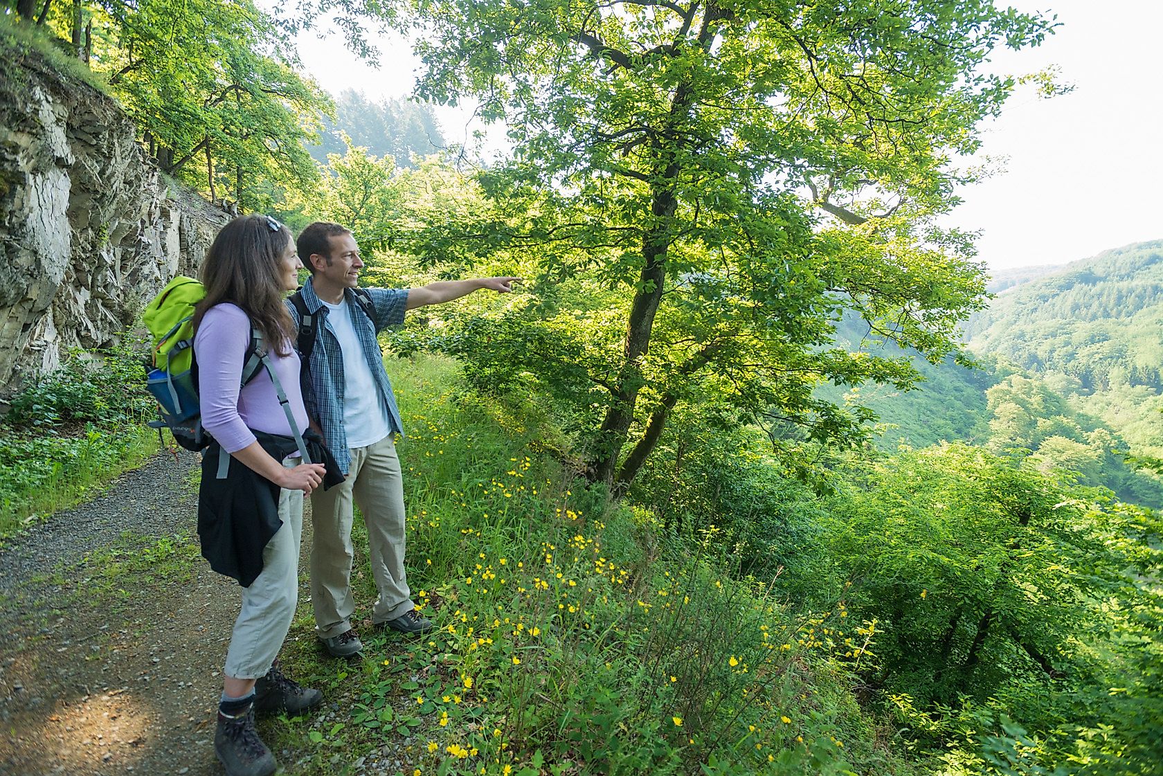
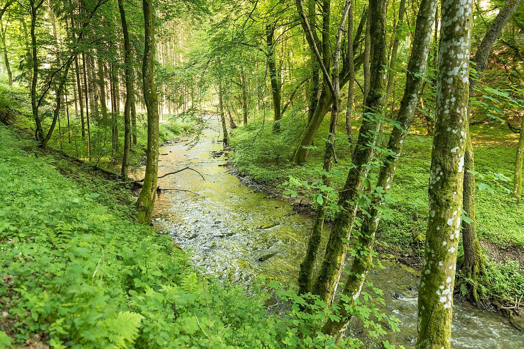
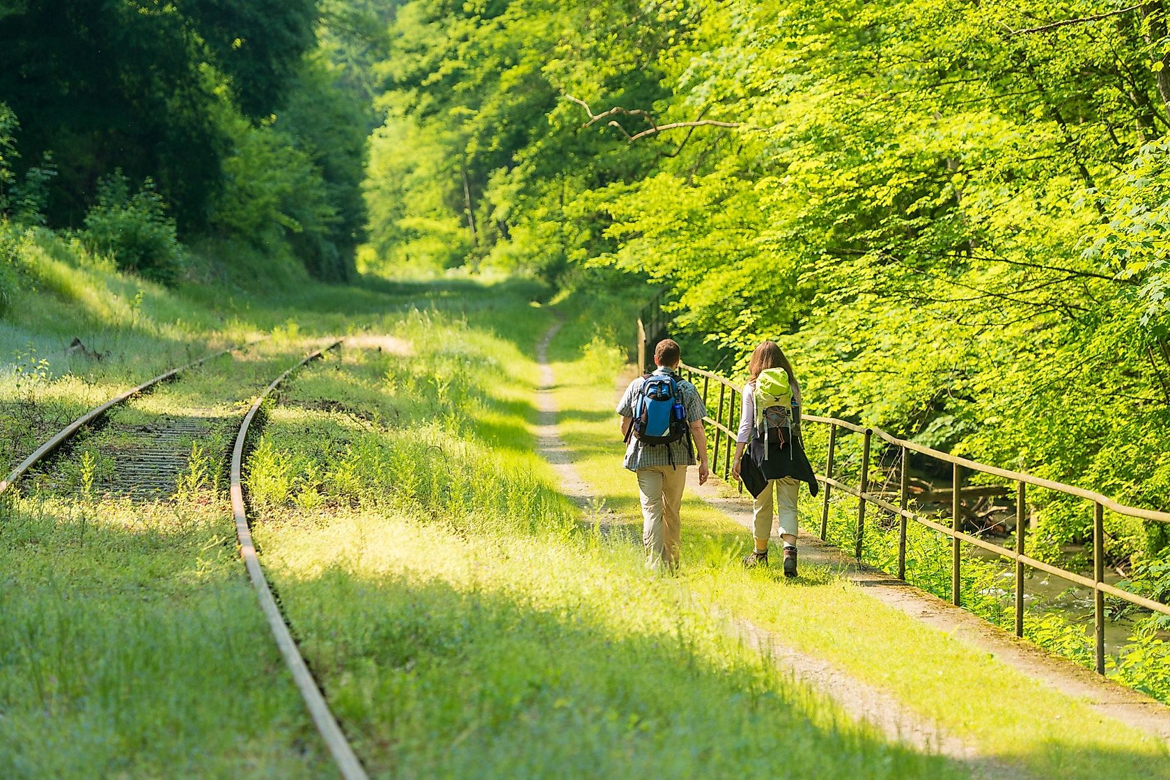
To the Tour PlanerThe Brexbach Gorge Trail leads us from wide heights with distant views to the Brexbach Valley. Idyllic forests, bubbling waters and a constant change of scenery provide excitement along the way. Again and again we cross the track of the Brexbach Valley Railway and admire the venerable viaducts. And the Grenzau ruins crown the tour with a touch of medieval flair...
The certified premium hiking trail Brexbachschluchtweg leads 16.4 km from Grenzau through the wild and romantic Brexbach valley and offers great views of the Rhine plain and the Westerwald.
From the freeway exit A48 - Höhr-Grenzhausen follow the road signs to the district Grenzau. In the center of town, before a small bridge, there is an entrance to a free parking lot for hikers on the left.
From the Ransbach Kirche stop, take bus 461 or 462 to Höhr-Grenzhausen (bus stop Schulzentrum) and continue with line 319 to the Grenzau/Kammerforst train station. Earliest connection from Ransbach church 5:50 am.
From bus stop Bahnhof Grenzau/Kammerforst take bus 319 to Höhr-Grenzhausen (bus stop Polizei) and continue with line 462 or 485 in the direction of Ransbach. Last connection 17:53 o'clock.
The bus connections can be found daily updated at www.bahn.de.
Free parking in Grenzau (Recommended address for entry in the navigation system: Brexbachstraße 11-17, 56203 Höhr-Grenzhausen)
Alternative starting points:
Weiherplatz in 56237 Nauort (from here there is a short connecting path to the Wäller Tour Brexbachschluchtweg signposted)Village community center in 56237 Alsbach
In the middle of Grenzau we follow the markings to Grenzau Castle. On a rustic forest path we hike up to the prominent rocks at the crossroads at the Kaiserstuhl. Here we turn left to the rock spur where a bench awaits us. Equipped with sturdy shoes, the path leads us in serpentines down into the Brexbach valley. In the valley we turn onto a forest road that leads to a forest path. We follow this through the high forest and reach the floodplain again. Across a meadow we pass the viaduct. After the next viaduct we change into the forest. Thus we reach the tracks of the Brexbachtalbahn. We follow the brook around the mountain spur, cross the railroad line and reach a forest crossing. Now we turn onto a path into the side valley. With some detours we conquer the terrain nose at the Teufelsberg and overlook the Brexbach valley. After 8. 5 km our view sweeps over the Neuwied basin. At a forest road we turn into the forest, which is replaced by meadows. We go downhill past the model airfield until we meet a road. We follow this road to the outskirts of Alsbach. Behind the village hall we walk again in the direction of open fields. At the edge of the forest we turn right and shortly after we come to a crossroads. On a path we go through a deeply cut gorge. We go to the road and turn right there. Soon a path leads us into the Masselbach valley. A dreamlike ascent follows. Finally we arrive at the K116 and use the "Kammerforster Steig", which leads to the train station Grenzau. We cross the road and turn onto a forest path. This leads us under a viaduct back to Grenzau. which is replaced by meadows. We go downhill past the model airfield until we meet a road. We follow this road to the outskirts of Alsbach. Behind the village community center we walk again in the direction of open fields. At the edge of the forest we turn right and shortly after we come to a crossroads. On a path we go through a deeply cut gorge. We go to the road and turn right there. Soon a path leads us into the Masselbach valley. A dreamlike ascent follows. Finally we arrive at the K116 and use the "Kammerforster Steig", which leads to the train station Grenzau. We cross the road and turn onto a forest path. This leads us under a viaduct back to Grenzau. which is replaced by meadows. We go downhill past the model airfield until we meet a road. We follow this road to the outskirts of Alsbach. Behind the village community center we walk again in the direction of open fields. At the edge of the forest we turn right and shortly after we come to a crossroads. On a path we go through a deeply cut gorge. We go to the road and turn right there. Soon a path leads us into the Masselbach valley. A dreamlike ascent follows. Finally we arrive at the K116 and use the "Kammerforster Steig", which leads to the train station Grenzau. We cross the road and turn onto a forest path. This leads us under a viaduct back to Grenzau. At the edge of the forest we turn right and a little later come to a crossroads. On a path we go through a deeply cut gorge. We go to the road and turn right there. Soon a path leads us into the Masselbach valley. A dreamlike ascent follows. Finally we arrive at the K116 and use the "Kammerforster Steig", which leads to the train station Grenzau. We cross the road and turn onto a forest path. This leads us under a viaduct back to Grenzau. At the edge of the forest we turn right and a little later come to a crossroads. On a path we go through a deeply cut gorge. We go to the road and turn right there. Soon a path leads us into the Masselbach valley. A dreamlike ascent follows. Finally we arrive at the K116 and use the "Kammerforster Steig", which leads to the train station Grenzau. We cross the road and turn onto a forest path. This leads us under a viaduct back to Grenzau.
Translated with www.DeepL.com/Translator (free version)
Hiking boots
Weather adapted functional clothing
To the left or to the right? The tour offers attractive perspectives in both directions. Tip: Test at different times of the year!
Hiking map-Leporello Wäller Touren, GPS-accurate hiking map with excursion destinations, refreshment & leisure tips, street names and elevation profiles, map size (W x H): 20 map pages à 18 x 20 cm, 9 red. Pages, 6,95 € - You can get the hiking map and the hiking book in the Westerwald-Shop at www.westerwald-shop.info!
Center Grenzau
Center Grenzau
More information & GPX download
Notice
In the tour planner we inform you under the tab "Current info" about temporary route changes, closures and detours.
To the Tour Planer