Hiking Trail
Route profile
Notice
In the tour planner we inform you under the tab "Current info" about temporary route changes, closures and detours.
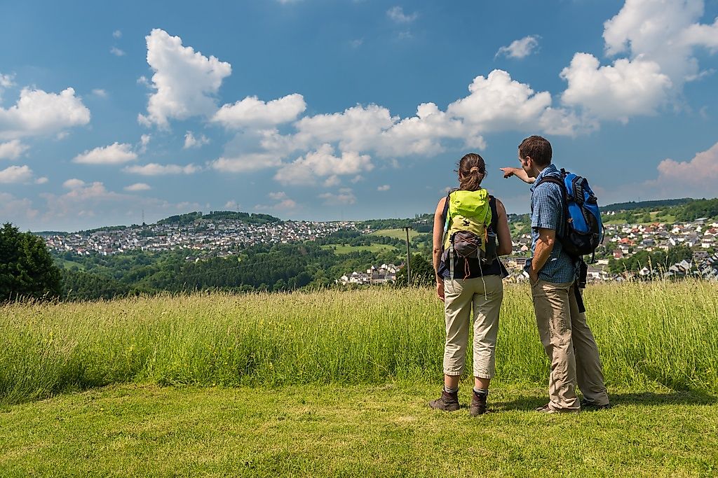
To the Tour Planer14 kilometres through the historiccultural landscape of the Augst bringme wonderful views and interesting sights. I startat the Neuhäusel-Ost hikers' car parkand reach the excellently marked premium trail. I head south alongmeadow paths in a southerly direction andenjoy the landscape. Natural paths lead through the floodplains of theof the Binnbach. There is a smallclimb before the forest. Then I hike up the Schlossberg to the accessibleSporkenburg ruins from the 11thfrom the 11th century. Thenthen descend along the Theilenbach stream to the L 329.I come across a farm track,I follow it in the direction of Arzbach across meadows and pastures. I satisfy my hunger in the old brewery. NowI climb up the Mühlberg, which I caneasier with the help of my trekkingeasier with my trekking poles. Wide views,including the watchtowers of theof the Limes, reward the effort. AtKadenbach there is a rest areawith a barbecue hut. The trail continues uphillto the "Maria in der Augst" chapel, which was only built in 1999/2000. Alast look at the surroundings andI walk back through the forestto the starting point.
The Wäller Tour Augst leads on approx. 14 km kilometers with varied ascents and descents past historically significant sights, such as the Sporkenburg castle ruins near Eitelborn.A connection to the Wäller Tour Augst is also possible in Simmern and the access road with a total length of 3.5 kilometers signposted from there.
From the south or north: via the B49 to the Neuhäusel Ost exit, drive over the motorway bridge and keep left until you reach the hiking parking lot
With the RMV bus line 460 from Montabaur ICE Banhhof and from Koblenz Hbf every hour. Exit and entrance: Neuhäusel Hauptstraße. From Bad Ems with the line "Modigel und Scherer" to Neuhäusel Hauptstraße. Once in the Wäller Tour Augst in both cases then take the marked access path.
Directly on the hiking parking lot
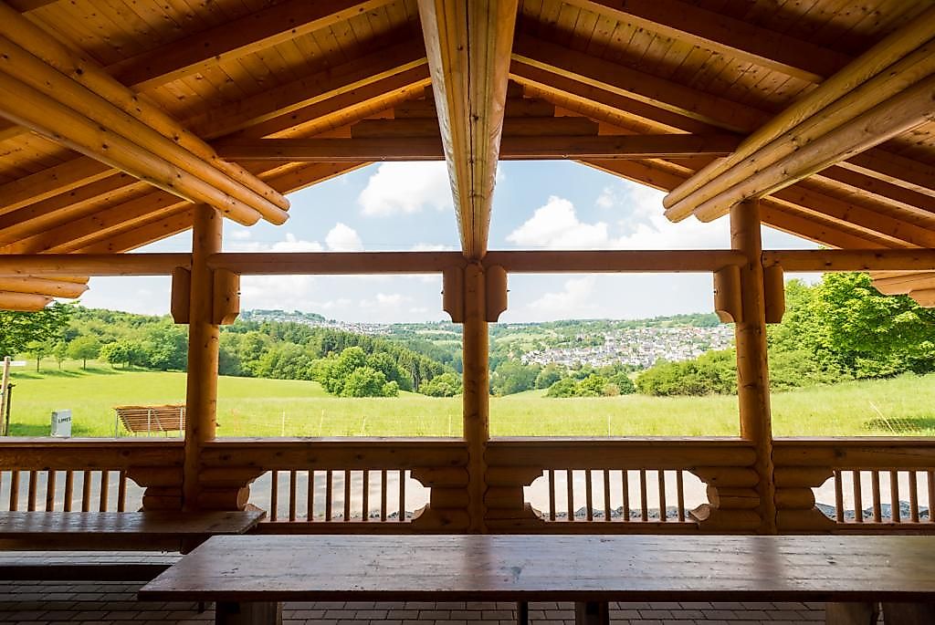
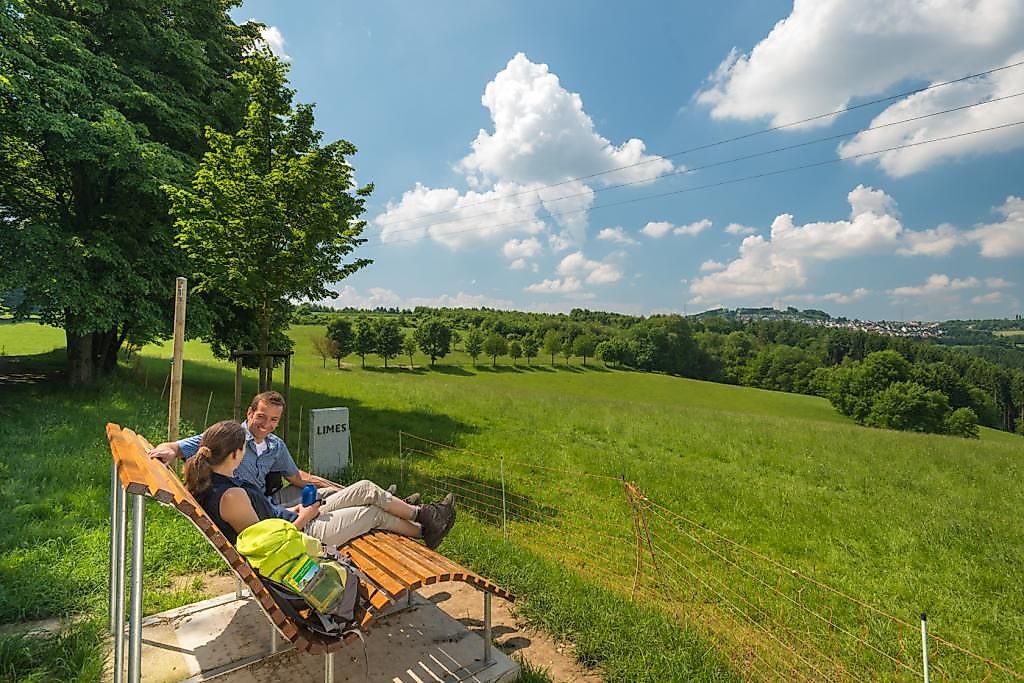
It is advisable to start the tour from the Neuhäusel-Ost parking lot. From here, the tour first heads towards Kadenbach, past the Kadenbach tennis court through orchard meadows with a great view over Eitelborn and Kadenbach. After crossing the Binnbach valley you reach the edge of Eitelborn. The route around the village is a gentle ascent, alternating between open country with paddocks and mixed forest regions. At about km 5 you enter the picturesque forest at the Schlossberg, after another 1.5 km you will see the Sporkenburg ruins on a spur of the Schlossberg, which are ideal for a rest (rucksack food!). After this rest, you can take a leisurely descent along the Theilenbach until you reach the Emsbach above Bad Ems and cross the L 329. A leisurely ascent follows the Emsbach to Arzbach. Here you can take a break in the Bierhaus, a restaurant where a brewery was operated until the beginning of World War I. Now a hard ascent to Mühlberg follows. Once at the top, the effort is rewarded with fantastic views over Arzbach (with Roman tower), then again Eitelborn and Neuhäusel. One reaches the new grill hut Kadenbach, a little later the chapel Maria in der Augst. This chapel was rebuilt around 2000 by the Verkehrs- und Verschönerungsverein on its own initiative on a historical site. A visit is worthwhile in any case. With a view over the Taunus mountains, you can take the Sonnenweg back to your starting point.
Zuweg (green "WT" on yellow background):3.5 km from the parking lot of the Simmern cemetery (exit of the village in the direction of Hillscheid) to Neuhäusel
In the winter months, the quality of the path may be impaired due to wood clearing work on individual sections of the path.
Sturdy shoes,
appropriate clothing adapted to the weather, binoculars if possible
A visit to the late medieval castle ruins of Sporkenburg, located about 1 kilometer south of Eitelborn, is worthwhile.
NEW from September 2019: The almost 10 km long hiking trail Wäller Schnippel connects the Wäller tours Augst and Elberthöhen.
Hiking map-Leporello Wäller Touren, GPS-accurate hiking map with excursion destinations, refreshment & leisure tips, street names and elevation profiles, map size (W x H): 20 map pages à 18 x 20 cm, 9 red. Pages, 6,95 € - You can get the hiking map and the hiking book in the Westerwald-Shop at www.westerwald-shop.info!
Hiking parking lot in 56335 Neuhäusel
Hiking parking lot in 56335 Neuhäusel
More information & GPX download
Notice
In the tour planner we inform you under the tab "Current info" about temporary route changes, closures and detours.
To the Tour Planer